Understanding ZIP Codes for Business Mapping
5 Digit and 3 Digit ZIP Codes
The USPS assigns ZIP codes to efficiently route the U.S. mail. Most businesspeople are familiar with the five-digit ZIP code. Many people are less familiar with the three-digit ZIP code prefix.
ZIP5 Codes:
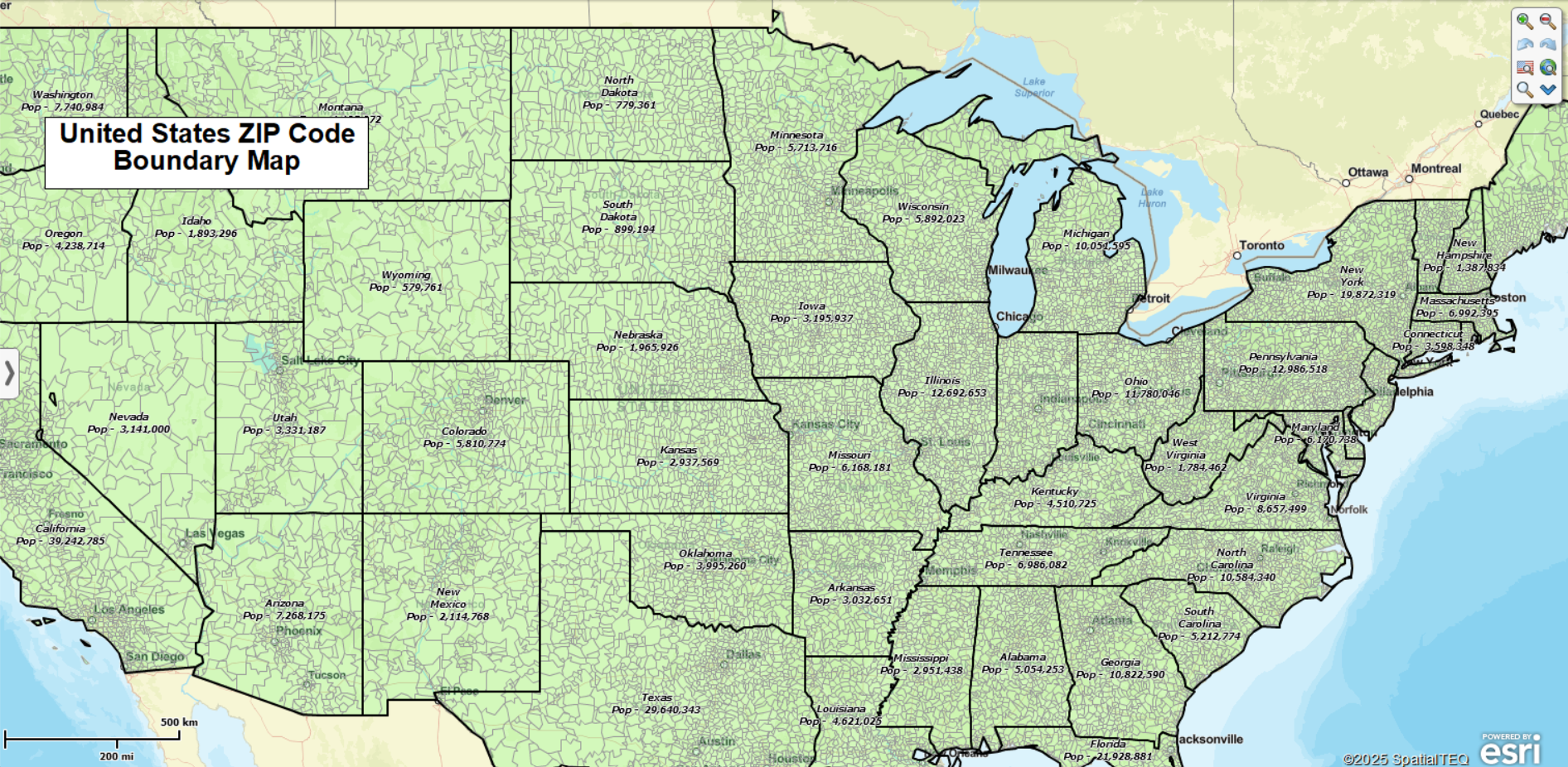
A ZIP5 is the standard USPS postal code associated with a delivery area. It is the most common ZIP Code we are familiar with. ZIP5 Codes are areas that often align with local community boundaries, although this is not always the case. For business mapping, ZIP5s are frequently used to define territories, visualize demographics, and run detailed customer analyses.
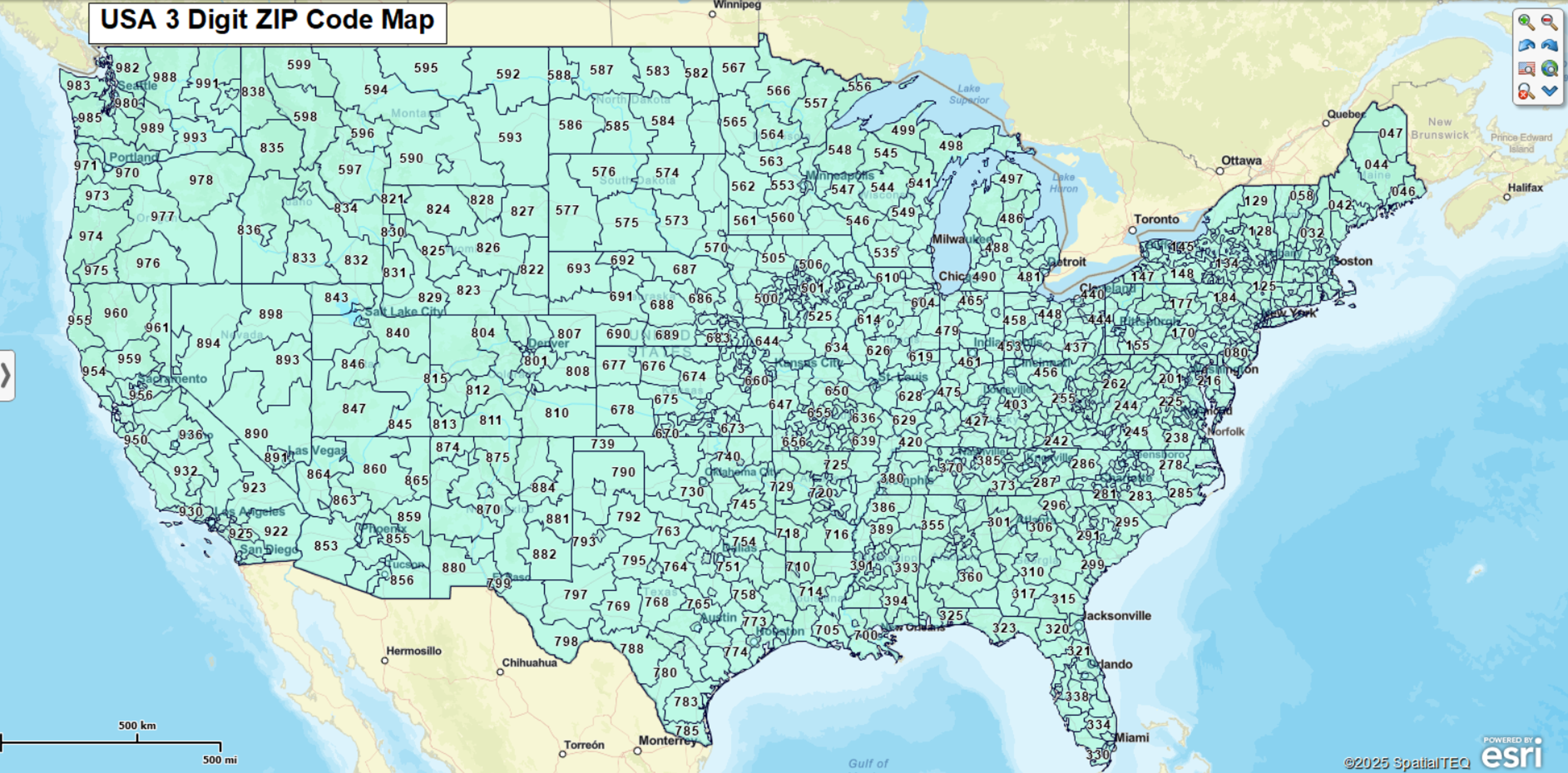
ZIP3 Codes:
ZIP3s are the first three digits of a ZIP5 code. ZIP3 areas group multiple ZIP5 codes together under one three-digit prefix. They are used for high-level mail distribution and make sense for business applications requiring a regional or roll-up perspective, such as national territory management or franchise planning. Read more about ZIP3 codes and view an interactive map here.
Census ZCTA ZIP Codes
First-time MapBusinessOnline users will note that the ZIP code layer delivered with a new subscription is set to the default of ZCTA ZIP codes from the US Census Bureau. ZCTA stands for ZIP Code Tabulation Area, a Census Bureau label.
ZCTA ZIP code and USPS ZIP5 code boundaries generally reflect identical boundaries. But there can be some differences. ZCTA is a Census Bureau version of ZIP codes, used to tabulate census data. ZCTA ZIPs are more closely aligned with Census block areas, where the USPS postal codes focus more on mail delivery and other USPS concerns. ZCTA ZIPs are designed to focus on more populated areas. Rural areas may not have associated ZCTA ZIP codes. Read more about ZCTA ZIP codes here.
When to use:
-
Use ZCTAs when working with Census-native datasets and statistics.
-
Use USPS ZIP5s for customer data, service, sales, or operational mapping.
Using ZIP Codes with Fillers
We recommend selecting the USPS ZIP codes with Fillers option because that ZIP5 code map layer option will automatically accommodate national parks and other park areas where ZIP5 codes do not exist. This fills non-delivery areas (parks, water, unassigned land) so your ZIP-based maps appear continuous, especially out west where national parks are a certified thing.
If you notice your maps have white spaces or inconsistent fill, it is probably from a lack of fillers. Using Fillers creates smoother, more professional thematic maps.
Understanding Boundary vs. Point ZIP Codes
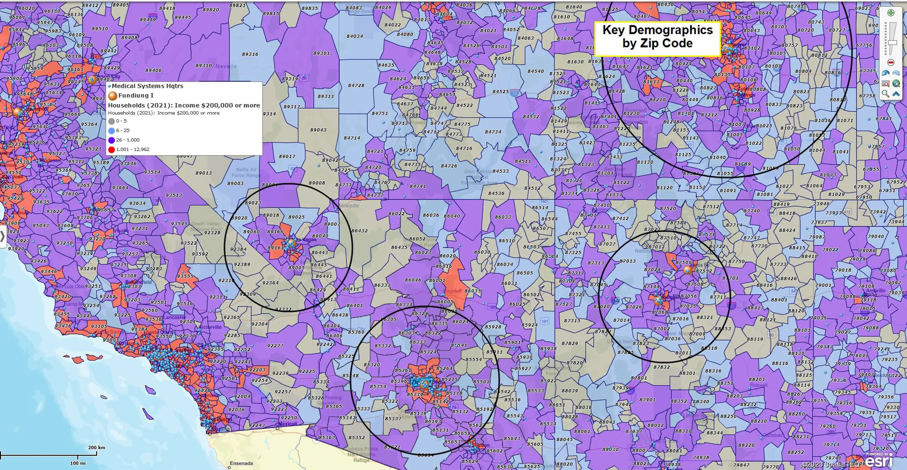
ZIP5 codes are generally attributed to and managed by the US Postal Service. The boundary ZIP5 codes form polygons used to create territories and areas of interest. A ZIP Code radius search of a ZIP code layer returns a collection of boundary ZIP codes for export.
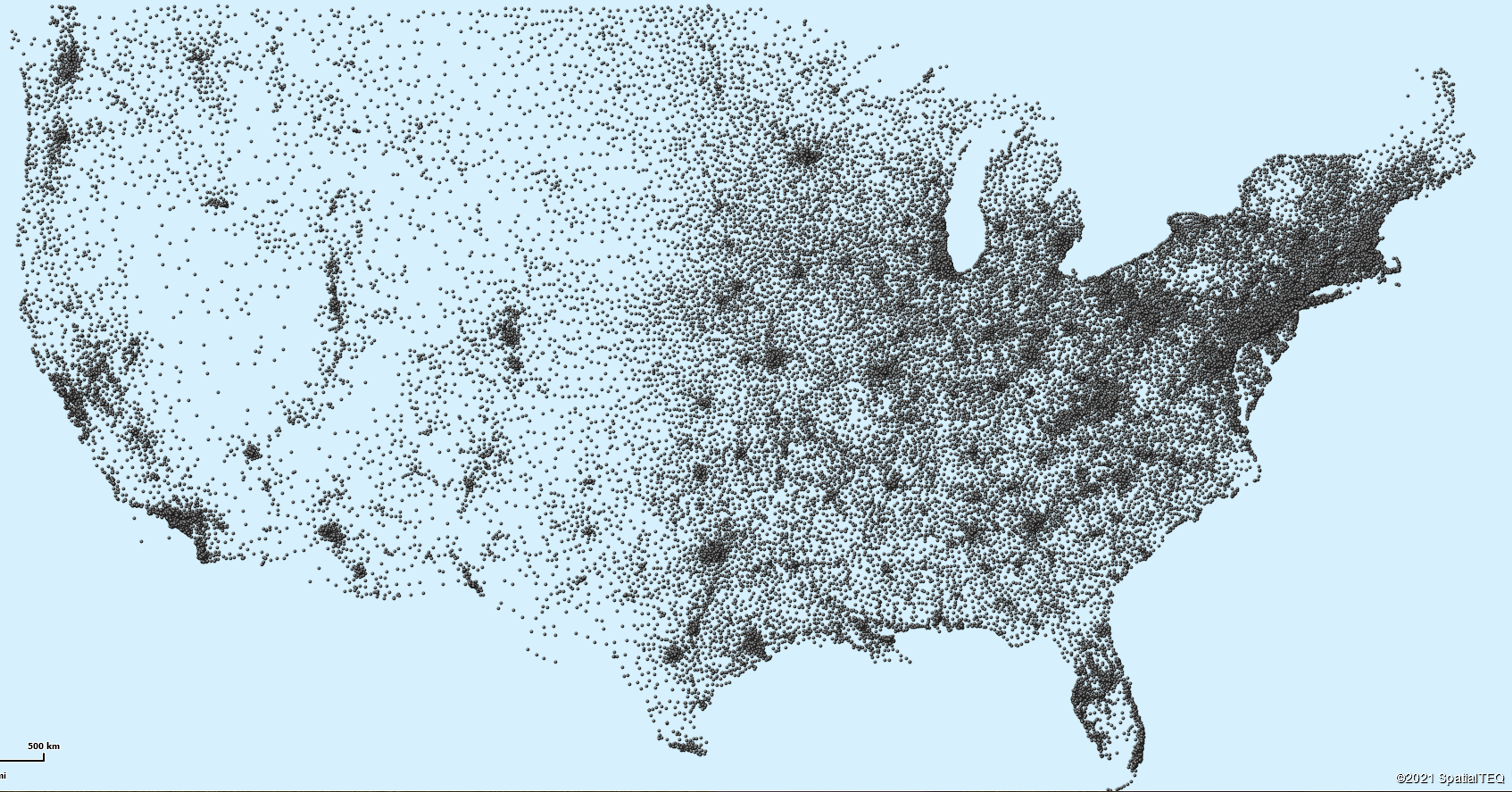
Point ZIP5 codes represent large USPS mail stops for big facilities like military installations, hospitals, congregate homes, or skyscrapers. The USPS ZIP Code list includes 33,420 boundary ZIP codes and 7,560 point ZIP codes, as of this writing. A complete list of Boundary and Point ZIP codes is exportable from MapBusinessOnline.
Practical Business Scenarios
-
Territory Frameworks: Start with ZIP3 for regional parity; refine and balance with ZIP5.
-
Market Sizing & Segmentation: Summarize demand or demographics by ZIP3; drill to ZIP5 for site selection.
-
Logistics Planning: Use ZIP3 for regional distribution views; pair with ZIP5 and drive-time analysis for detailed operations.
Explore Next Steps
ZIP Code Maps — Build, visualize, and share ZIP-based maps.
Territory Management - Create and manage sales and service territories using ZIP3 and ZIP5.
Radius Maps — Define catchments and delivery/service areas.
Ready to Build Your Own ZIP Code Maps?


