
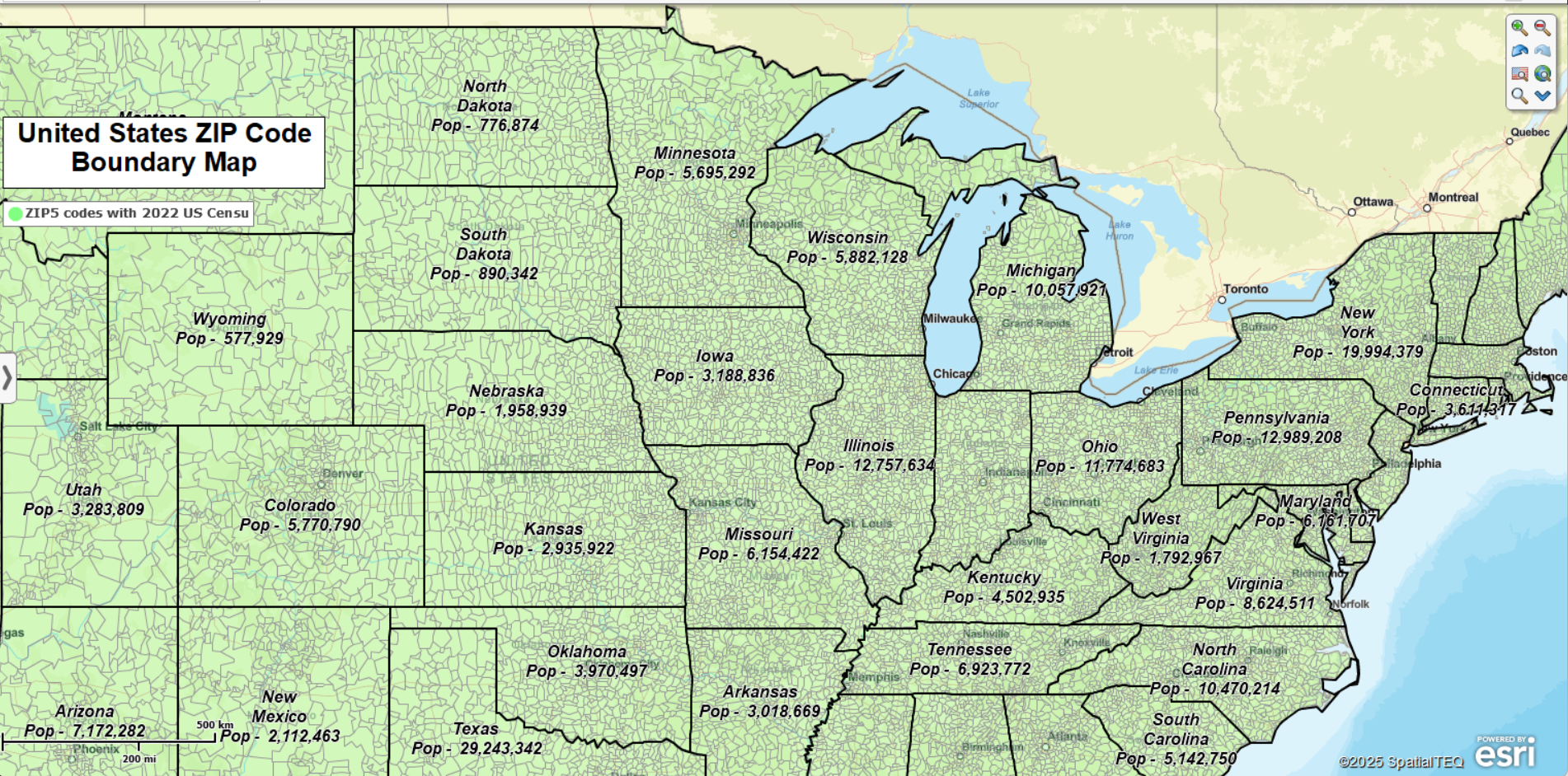
The ZIP code map displayed and linked to above shows boundary ZIP codes across the USA. State populations are totaled in the State label.
Open the interactive map above by clicking the map link and view any ZIP code area across the USA. The downloadable map viewer app allows you to find ZIP codes on the map by typing them into the search bar (top left). You can also find ZIP codes within a certain radius of a point, export a map image for any ZIP code area, or even estimate the driving distance between ZIP codes using the routing tool.
Two Types of ZIP Codes
MapBusinessOnline supports and displays two types of ZIP codes: Point ZIP codes and Boundary ZIP codes. Boundary ZIP codes constitute general city and town postal delivery areas with specified boundary zones. Point ZIP codes are unique large building mail drop-off locations for heavy mail deliveries at organizations such as military stations, skyscrapers, assisted living centers, or hospitals.
Learn more about USPS ZIP codes at the USPS ZIP code FAQ.
Why Use ZIP Code Mapping Software?
MapBusinessOnline users apply ZIP code mapping tools to a variety of business solutions, including:
- Define delivery, franchise, sales, service territories that help manage and analyze business activities.
- Access demographic data by ZIP code – Color-code ZIP code areas and download demographic information.
- Generate color-coded ZIP code maps of imported customer and competitor location data.
- Create market analysis and sales potential maps by overlaying ZIP code with numeric business data, demographic data, and other location-based datasets.
- Develop efficient, optimized vehicle routes for deliveries, sales routes, or field staff management.
- Create heat map data visualizations that display the intensity of business activity by point or ZIP code area.