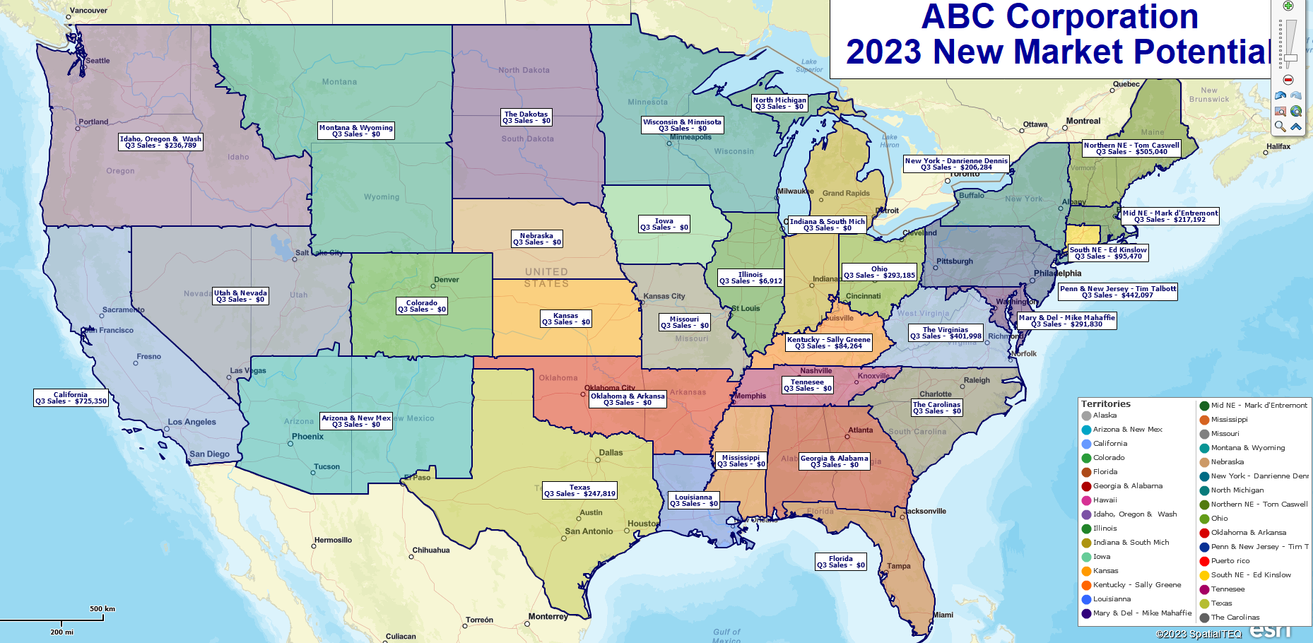
A nationwide ZIP code-based territory map, created using MapBusinessOnline.
Does the above map call out to you? Is this territory scheme similar to the map you want to create for your business? If so, read on to learn how to create a nationwide territory map.
MapBusinessOnline is specifically designed to enable the creation of beautiful and informative business maps by everyday business people like you and me. There is no need to hire a cartographer or a GIS specialist when you’ve invested a few dollars into MapBusinessOnline. Territory map capabilities within MapBusinessOnline can be applied to sales organizations, franchise businesses, and service organizations.
First, Adjust the ZIP Code Data Source
To create the best-looking territory maps, adjust the ZIP code settings in MapBusinessOnline for territory creation. Use the ZIP code with the Fillers option set in Map and Data.
- Open Map & Data (the gray map layer check box hovering over your map.)
- Select Map Options and then the ZIP code Tab.
- In the Check box at the bottom of the panel, drop down to and select ZIP codes with fillers.
This setting automatically deals with the non-ZIP code areas that pepper the United States, including national parks, extremely rural sections out west, and military installations. ZIP codes with Fillers merge those unassigned areas with the abutting ZIP codes, making your map view solid and consistent. Remember that you can’t fix these unassigned areas of your map later; you must select this setting before starting your territory map. Once selected, you’re all set – forever.
Determine Your Base Map Alignment Layer
As you can see, the state-level territories created in the above map, in many cases, combine multiple states. MapBusinessOnline has rules for territory creation across jurisdictions that keep things organized:
- Combined and split state territories must be created from lesser map alignment layers – i.e., ZIP codes or Counties.
- While not recommended, overlapped territories can be created and configured to stand out visually using Territory Options in Map and Data. Learn more about Territory overlap.
ZIP codes are the most common map alignment layer used to create territories. ZIP codes provide the most flexibility in territory creation for a USA-wide map where territories are roughly outlined by state(s). A territory creator must choose which map alignment layer makes the most sense for their particular territory map requirement:
- Most franchise organizations use ZIP codes for their territory map alignment layer because they offer easily compiled segmentation with accurate and up-to-date demographic data.
- Rural service orgs lean toward counties for their map alignment layer.
- Large and national organizations sometimes choose states as their map alignment layer unless they have hierarchical tiers that tend to favor ZIP codes or Counties.
National Territory Creation
MapBusinessOnline provides several ways to create a nationwide territory map. If you have all your ZIP codes neatly assigned to a territory in one spreadsheet, you can import the territory spreadsheet and quickly set up ZIP code-based territories.
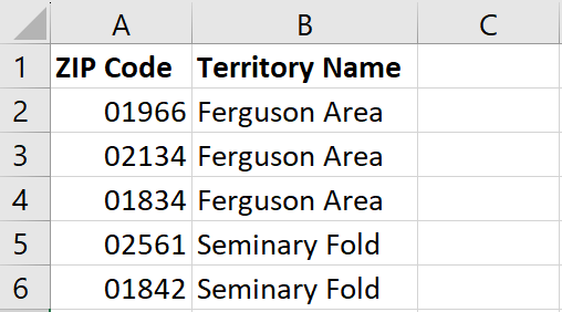
An example of a ZIP code-based territory import spreadsheet.
MapBusinessOnline’s territory import process now supports hierarchical territory imports as well.
Suppose a territory creator does not have a territory spreadsheet to import. In that case, the best way to create a nationwide territory is by gathering groups of ZIP codes using a Polygon Search Tool.
If your company only requires whole state-level territories – territories made up of one or more whole states – it’s easy to select individual states with your mouse cursor, hold the shift key down to select more, and then name the resulting territory. However, most territories are more complex and, as such, require the flexibility of a ZIP code bases map layer.
The ZIP code territory creation process:
In Map and Data, Check on the ZIP code layer and adjust for transparency.
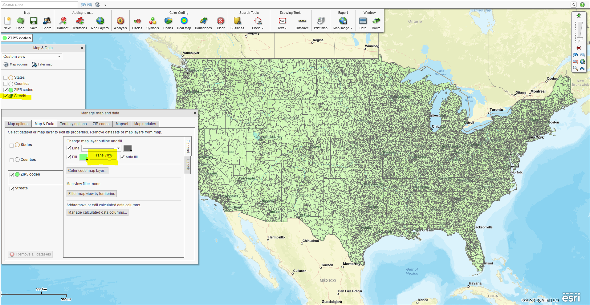
Adjust the ZIP code map layer for transparency.
- Turn on the State Layer for reference, and uncheck the state color Fill, which prevents ZIP code selection. Darken up state boundaries in Map and Data for clearer guidance as you select groups of ZIP codes.
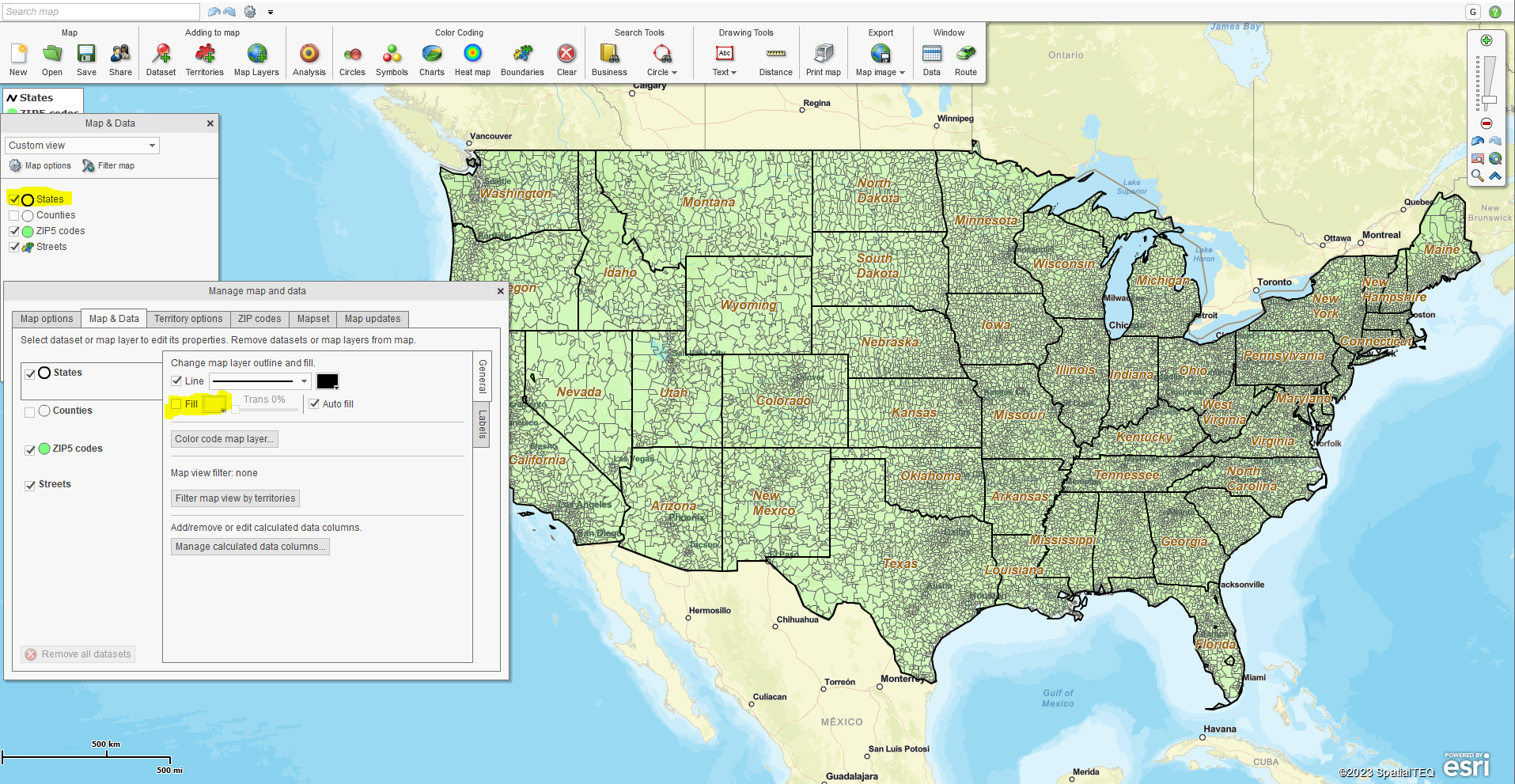
Optimize the state layer – darken boundaries and uncheck fill.
- Under Search Tools on the Master Toolbar, select the Polygon option. Place your cursor on the map where a selection of target ZIP codes exists and run the polygon inside the targeted ZIPs’ borders, connecting the polygon back to the starting point. A dialogue box opens – select the ZIP code layer.
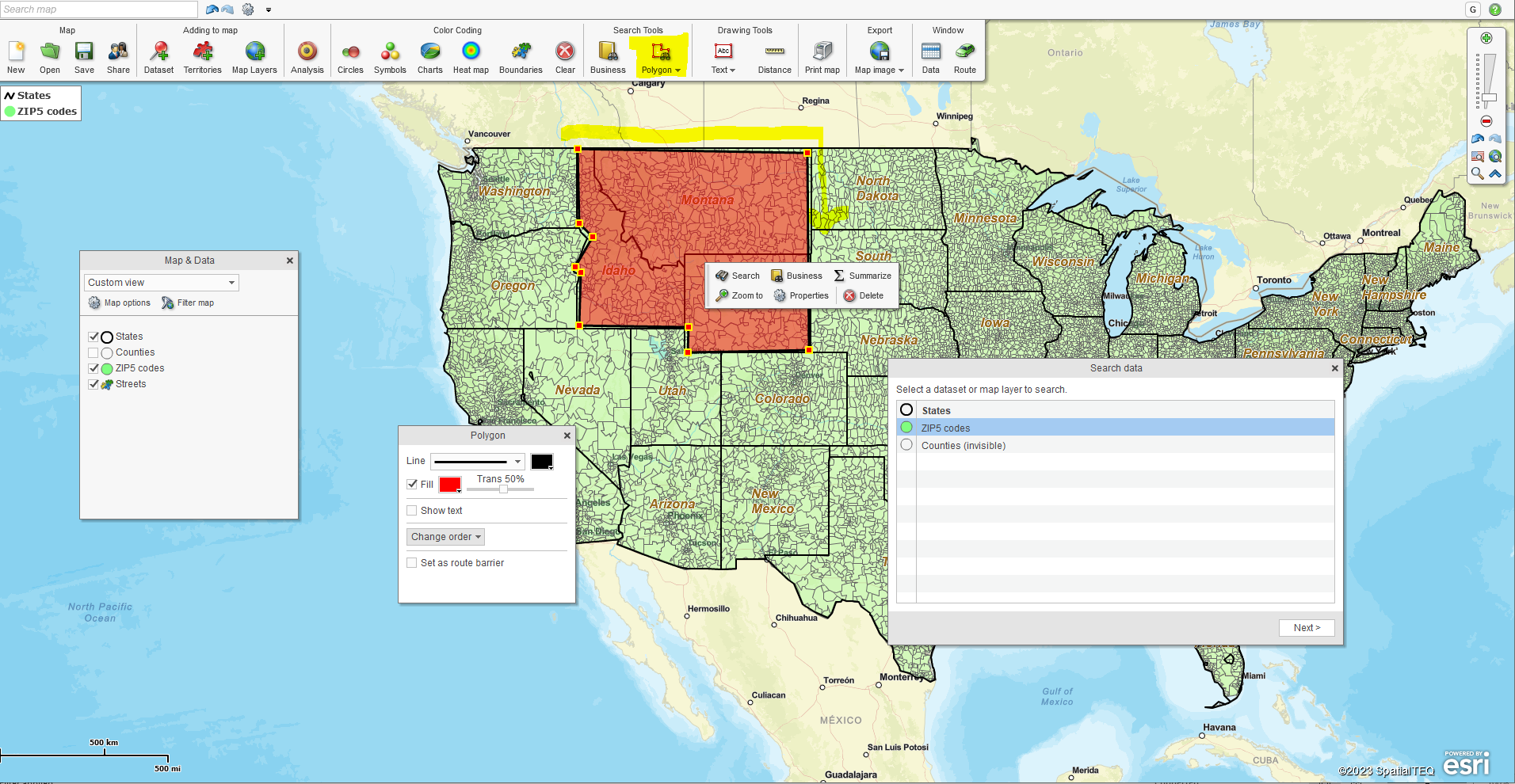
Select a group of ZIP codes using the polygon tool.
- Click Next and name the Territory. There is a notes box in the naming dialogue for reference information. Try creating and deleting a few territories to get the hang of it.
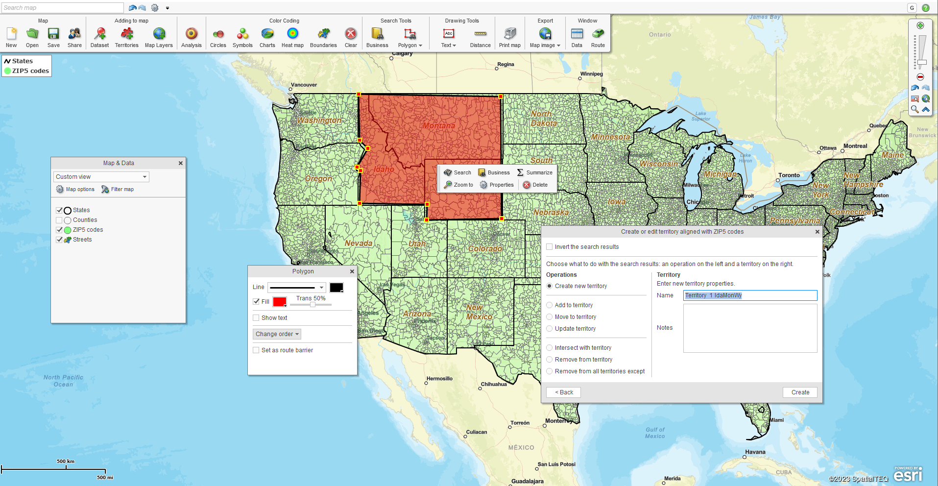
Name the created territory. You can always rename the territory later.
- The territory Data Window view appears. This tabular data view is designed to manage data associated with your territory. Remove redundant data using the Choose Columns button in the lower right. You can add demographic, imported sales, or business listing data in the Data Window territory view. All additional territories created will include the same imported tabular data layers in the data window view.
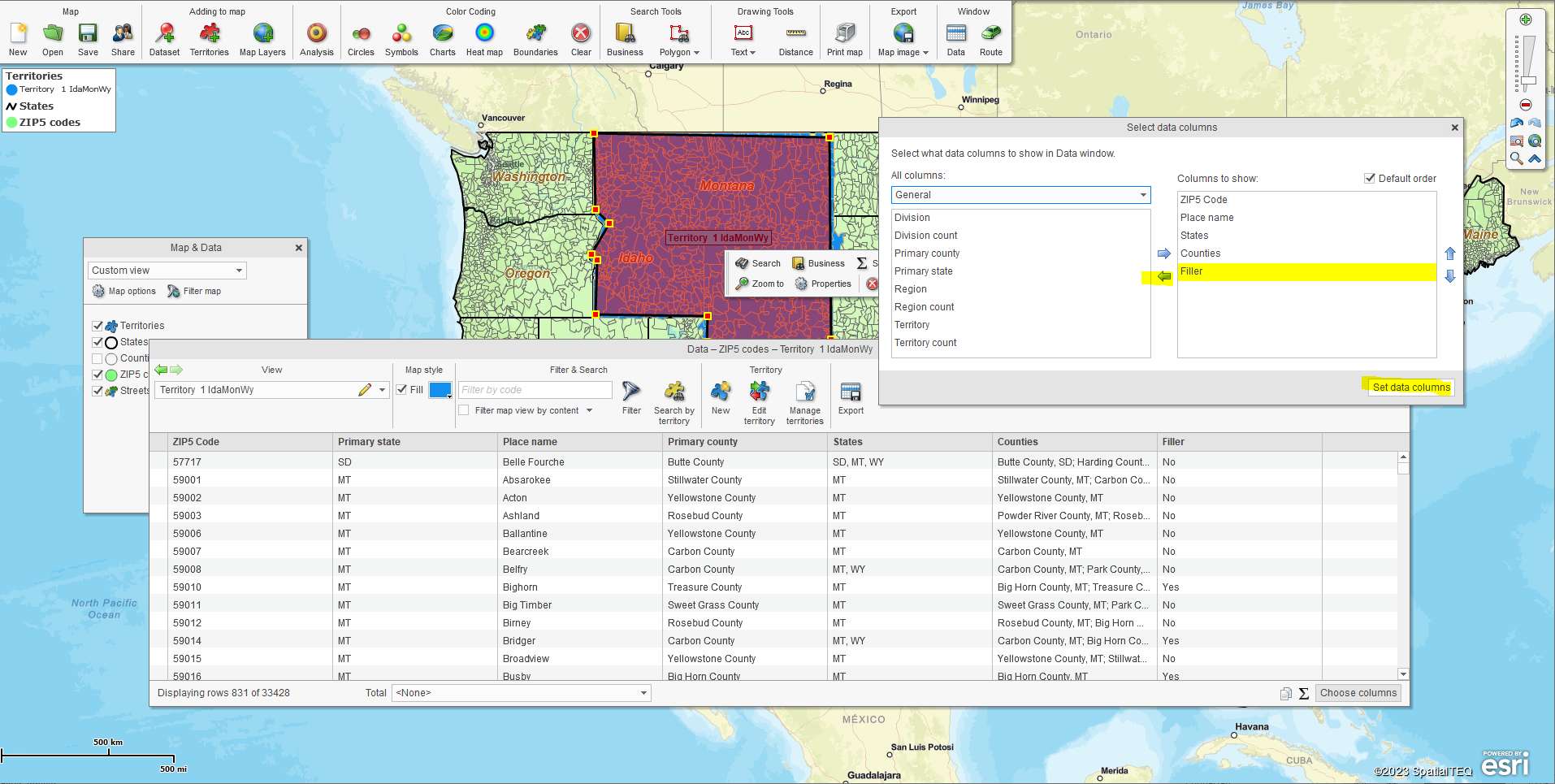
Adjust the Data Window view by adding imported data and or demographic data.
- Delete the ZIP code gathering Polygon by clicking Delete in the associated dialogue box.
- Repeat the territory creation process until the entire USA or regional coverage area is completed and all territories are named.
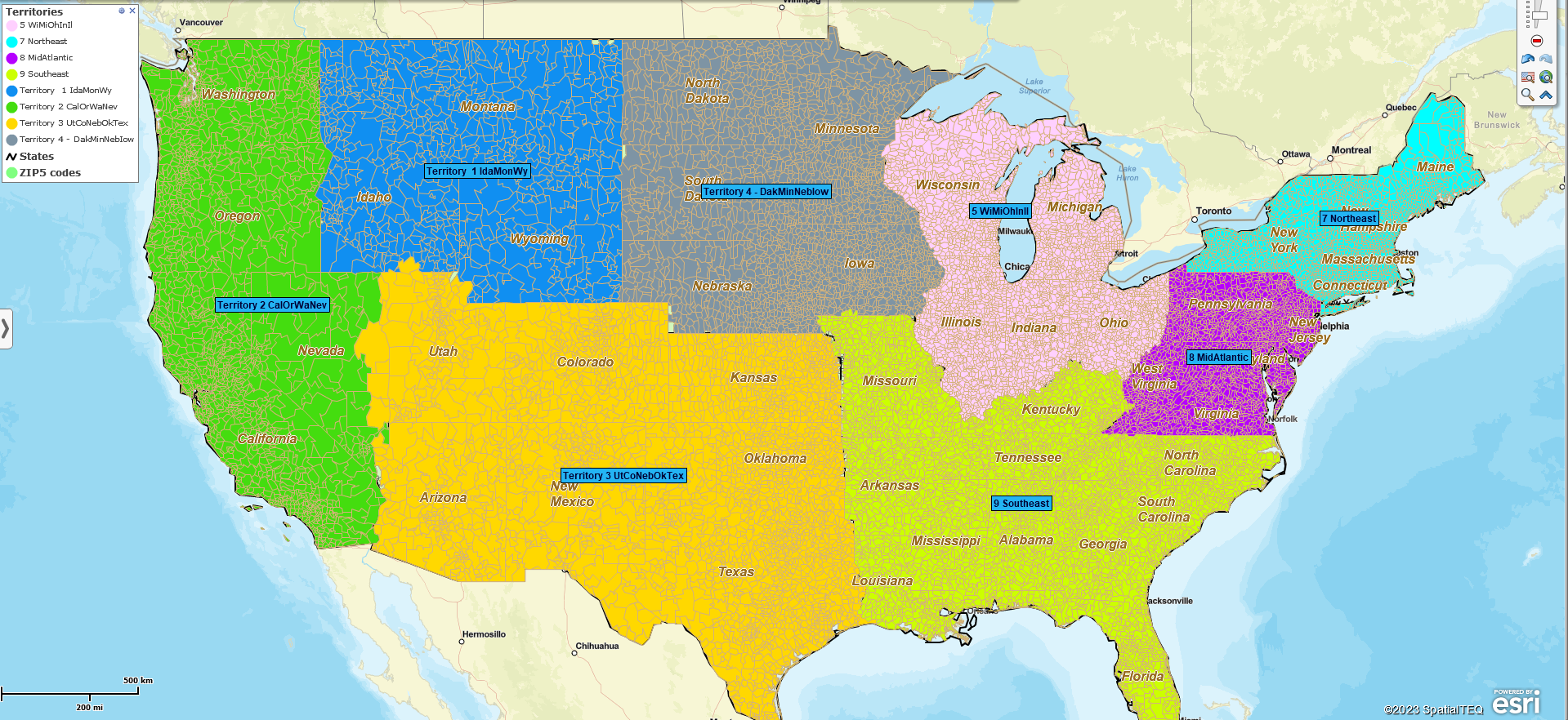
An unoptimized rough draft nationwide territory map.
The above territory picture is a rough draft of my final map. It still needs some fine-tuning. The territories are all in place, but you must adjust border areas that may have missed small ZIP codes, especially along river borders. This is just a tedious fact of territory creation. Many tiny ZIP codes require editing, especially in the east of the USA, where rivers are boundaries.
Territory edits out west are easy:
- Zoom into the area or territory.
- Select an unselected ZIP code with your cursor and hold down the Shift Key.
- Select all the other ZIP codes requiring inclusion.
- Click the Edit Territory option in the open dialogue.
- Select the Add to Territory Option and select the target Territory.
- Click the Edit option in the lower right.
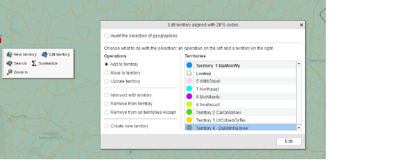
The Edit Territory dialogue. Choose the manner of Edit required on the right and select the target territory.
Let’s look closer at a map section:
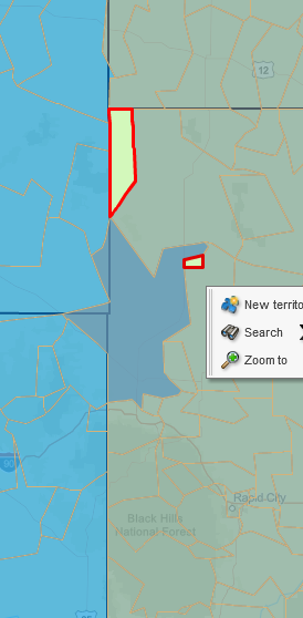
Area requiring territory edits.
The snippet of the territory map to the left shows several potential edits.
The two light green ZIP codes with the red border are unassigned. They were missed in the territory creation process. Select them (select one, hold down the shift key, and select the other) and Add them to the green territory.
Notice the darkened ZIP code at the border of three states. That indicates overlap. It also shows that ZIP codes do not always align with state boundaries. In this case, I recommend removing the ZIP from the territory to the west and leaving the ZIP in the territory to the east because most of the ZIP area exists there. Once the ZIP is selected, options display for selecting either a territory or the ZIP code. Choose the ZIP and use the option to Remove from All Territories Except.
The Edit Territory dialogue provides various ways to edit misapplied ZIP codes:
- Add to territory – Select and Add to.
- Move to territory – Switch a ZIP code or selection of ZIPs from one territory to another. Choose the territory to move to, and the application will remove ZIP from the previous territory and place it in the target territory.
- Update territory – Select a group of ZIp codes and update the entire territory with that selection.
- Remove from territory – You guessed it – select and remove those ZIP codes.
- Remove from all except – This is handy when you incorrectly assigned a selection of ZIPs to one or more territories but want to preserve the selection you added to the correct territory.
Fine Tune Your Map’s Look and Feel
Once your ZIP code territories are reviewed, you can fine-tune your map’s look and feel. These adjustments are suggestions. Use your judgment. Make adjustments, and then take a look. Think about how your map audience will react.
- From the nationwide view – consider the labels. Do they make sense? Will they invite criticism? Are they woke enough? (OK – that’s a joke! Lighten up!) Adjust as necessary.
- Consider adjusting colors – Avoid colors that are too bright or too dark. Keep similar color shades separated.
- In Map and Data > General, check Hide Internal Boundaries.
- Turn off the ZIP code layer. Decide if that looks better.
On my map, I made the following adjustments:
- Renamed the territories to develop a consistent, readable naming system.
- Darkened the territory boundaries.
- Removed the ZIP code layer and checked the Hide Internal Boundaries box.
- Adjusted territory colors to be more pastel and less offbeat.
- Adjusted the territory label positions.
- Removed the state layer auto label and transparentized territories. The state label bleeds through from the Street data layer.
- Simplified the legend and placed it in the pocket of the Atlantic coast, where a rectangular image would include the legend.
The contiguous USA territory map view.
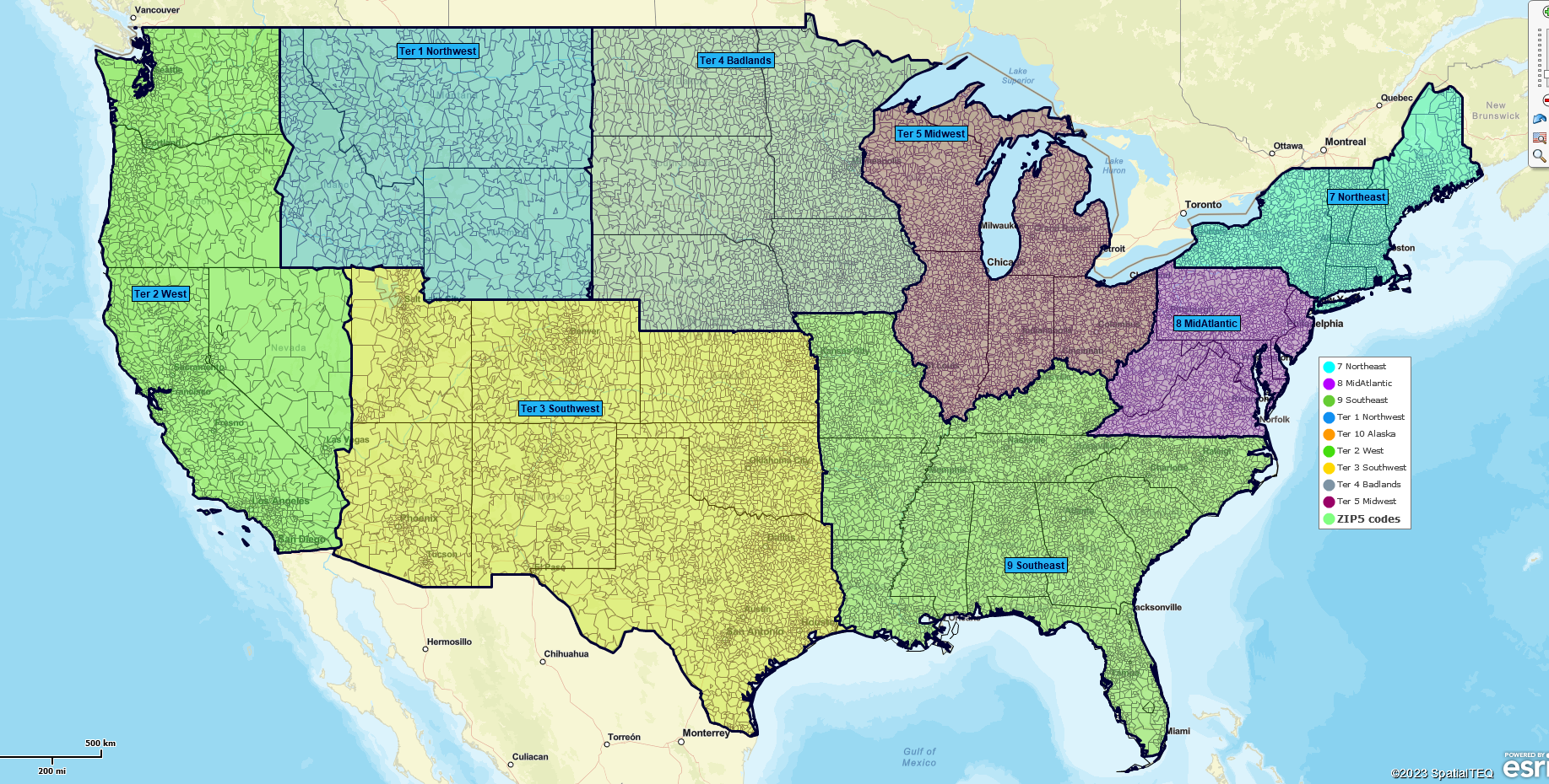
My nationwide map contiguous view.
Lastly, a conterminous view, with Alaska included:
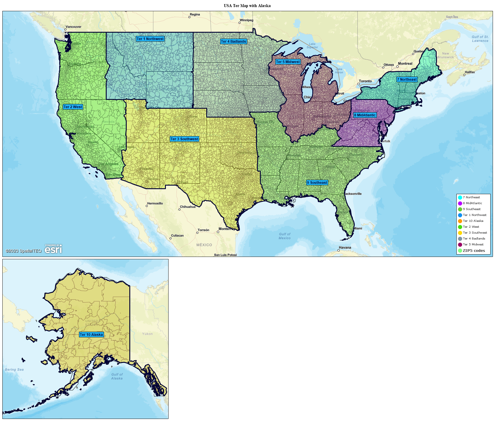
USA territory map with Alaska.
Conterminous view, including Alaska and or Hawaii, is an option in the image file export button.
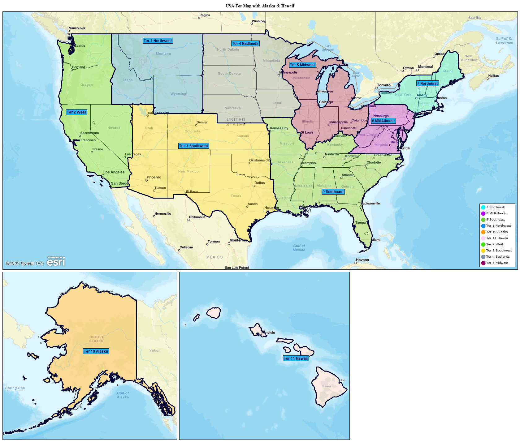
Conterminous with Alaska & Hawaii.
Feel free to request a territory creation web demo.
